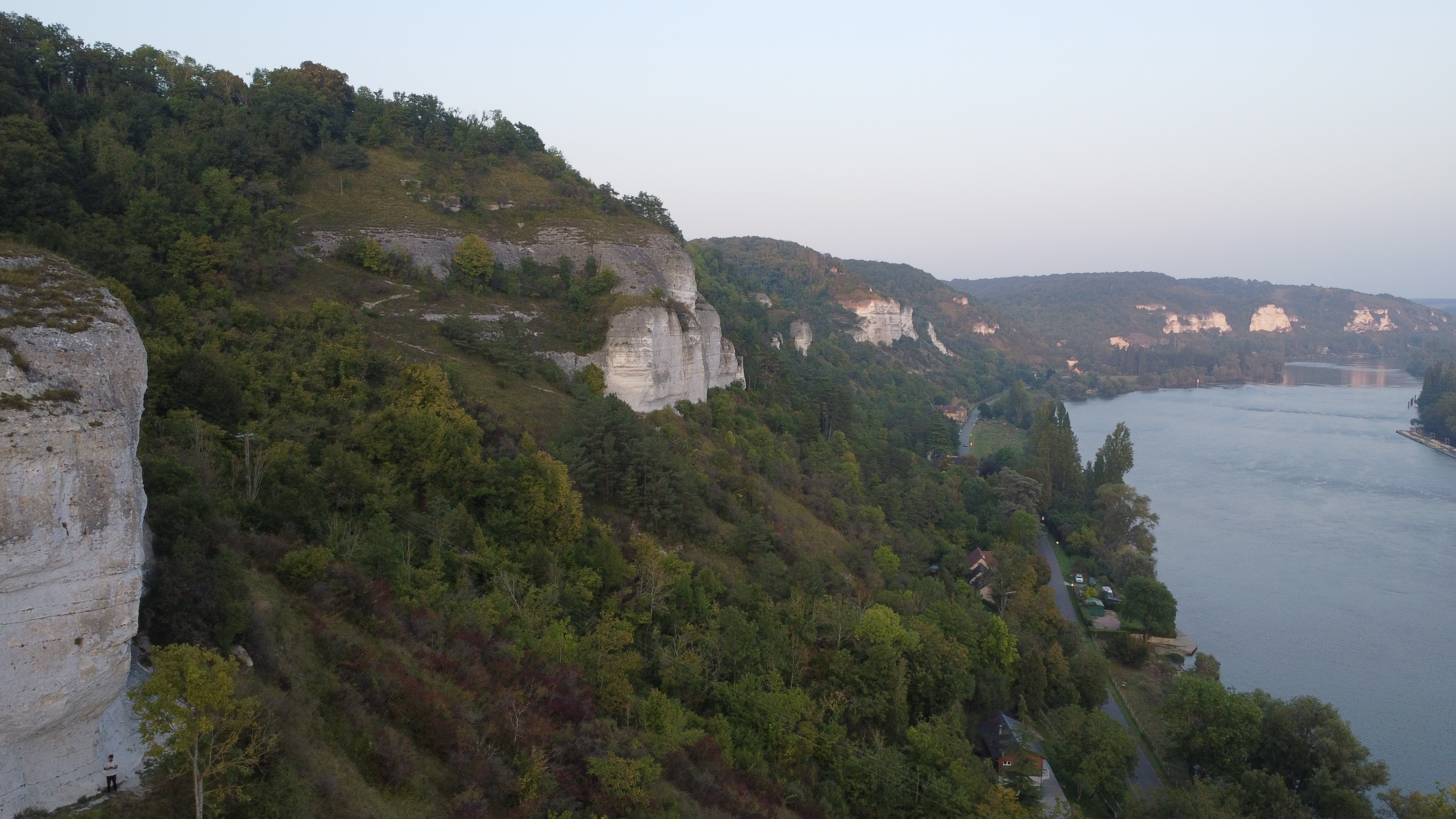
Seine valley crags · Eure
Climbing at Les Andelys
Twelve white chalk crags above the bends of the Seine, an hour and a half from Paris. One digital guidebook per crag, made with the Eure climbing committee.
- 12 crags
- From €5.99 per crag


Each sector unlocks in the app for €5.99 to €9.99, or get every Les Andelys sector at once for €29.99.
Les Andelys, Paris climbers' chalk getaway
With its magnificent cliffs along the Seine and its rich history, the Andelys climbing site is a must-visit for climbers in the Paris region. The multitude of routes of all levels makes it an ideal place for both beginner and advanced climbers. OneTopo in partnership with the Eure territorial committee offers you a complete digital guidebook to discover this site
Each crag has its own character: Connelles and its well-bolted routes facing the Seine, Val Saint-Martin and Le Thuit for a change of scene, from beginner walls to more sustained lines, and a handful of small crags such as La Microfalaise, Le Dé or Le Der for days when you want some peace and quiet. All along the valley the chalk is studded with flint: the nodules often make the holds, and footwork comes down to millimetres on their smooth surface. Here you climb with your eyes as much as your arms.
No need to buy the whole valley: each crag unlocks separately in the app, or all at once with the Les Andelys bundle. Either way, most of the price goes to the committee that bolts and maintains the routes.
The Les Andelys crags
L'M
€5.99Sport · Multi-pitch
Guidebook made with Pascal Bocianowski & CT FFME de l'Eure
Bisexto
€9.99Sport
Guidebook made with Pascal Bocianowski & CT FFME de l'Eure
Microfalaise
€5.99Sport · Multi-pitch
Guidebook made with Pascal Bocianowski & CT FFME de l'Eure
Connelles
€9.99Sport · Multi-pitch
Guidebook made with Pascal Bocianowski & CT FFME de l'Eure
La Cariée
€5.99Sport
Guidebook made with Pascal Bocianowski & CT FFME de l'Eure
Spéléologue
€9.99Sport · Multi-pitch
Guidebook made with Pascal Bocianowski & CT FFME de l'Eure
Le Thuit
€5.99Sport
Guidebook made with Pascal Bocianowski & CT FFME de l'Eure
Le Val Saint Martin
€9.99Sport · Multi-pitch · Trad
Guidebook made with Pascal Bocianowski & CT FFME de l'Eure
La Seconde Jeunesse
€5.99Sport
Guidebook made with Pascal Bocianowski & CT FFME de l'Eure
Le Capucin
€5.99Sport
Guidebook made with Pascal Bocianowski & CT FFME de l'Eure
Le Der
€5.99Sport
Guidebook made with Pascal Bocianowski & CT FFME de l'Eure
Le Dé
€5.99Sport
Guidebook made with Pascal Bocianowski & CT FFME de l'Eure
Getting to Les Andelys
Both the upstream and downstream sectors are easy to reach by train + bike from Paris.
Car-free access to Les Andelys, upstream sectors
- From Paris: train to Gaillon-Aubevoye (about 1 h, one train per hour), then 47 min by bike (13.4 km, 60 m up), mostly on cycle paths along the Seine.
- About 5 min approach walk; mostly south-facing sectors, very hot in summer.
Detailed route, profile and GPX track on Vélogrimpe.fr
Car-free access to Les Andelys, downstream sectors
- From Paris: train to Val-de-Reuil, then about 32 min by bike (9.4 km, 30 m up).
- From Pont-de-l'Arche station: about 32 min by bike (9 km, 40 m up).
Detailed route, profile and GPX track on Vélogrimpe.fr
FAQ: climbing at Les Andelys
Where can I climb at Les Andelys?
Around Les Andelys and Connelles, in the Eure, a dozen chalk crags line the Seine: Connelles, Val Saint-Martin, Le Thuit, Le Capucin, La Cariée, La Bisexto, La Seconde Jeunesse, L'M, Spéléologue, La Microfalaise, Le Der and Le Dé.
How can I climb at Les Andelys without a car?
For the upstream sectors, take the train to Gaillon-Aubevoye then allow about 47 minutes by bike, mostly on a cycle path along the Seine. For the downstream sectors, get off at Val-de-Reuil then allow about 32 minutes by bike.
How much is the Les Andelys guidebook?
The OneTopo app is free. Each crag unlocks for €5.99 to €9.99, or all Les Andelys crags at once for €29.99. Most of the price goes to the Eure climbing committee.
Is there a PDF guidebook for Les Andelys?
The OneTopo guidebook isn't a PDF: it lives in the app, with every route drawn on photos, and works offline at the foot of the crags. The app is a free download on iOS and Android.